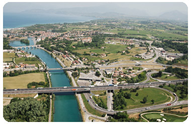
ORTHOPHOTO
The techniques and software that allow for years to prepare the orthophoto: complementary products but not replace the maps that allow a reading less technical but more intuitive impact on the reality of the place. It' widely used in the expeditious review and update of spatial data and thematic analysis as a valuable support in the area.
The orthophotos are a result of georeferencing, orthogonalization, mosaic and equalization of aerial images in the default coordinate system through a procedure known as aerial triangulation.
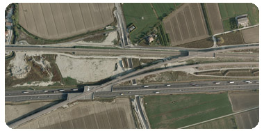
DSM and DTM generation, digital surface model (DSM) is calculated through the autocorrelation of digital images (or digital ). The model describes and defines the soil surface in its entirety, incorporating all the elements such as infrastructure, buildings and the level of vegetation that insists on it.
The software that allow, through specific algorithms, a sorting of these items, remove them to obtain the digital terrain model (DTM) that describes the morphology of bare ground. The elevation models (DSM and DTM) are used for both the ortophoto production in other GIS applications.